Reflexes stay on the aircraft
Stabilization, obstacle braking, RTH and failsafe run on the flight controller. They keep working if every link dies mid-mission.
ÆTHER / Technology
The reusable value is not a single drone. It is the orchestration layer connecting autonomy, media and operations — and it lives on the ground, where we can give it real compute.
Video and telemetry come down; detection, prediction and shot selection happen on the ground; validated commands go back up. Between them sits a safety layer that cannot be overridden by the director.
Everything that makes a flight useful — vision, positioning, route logic, safety — runs on our ground station. A thin adapter is the only part that knows which aircraft is in the air.
That is deliberate. Airframes get discontinued, restricted and repriced. When one does, we change an adapter instead of rebuilding a product. Basic stabilization and safe mission termination always remain onboard — the aircraft never depends on remote compute to stay in the air.
Camera → encoder → radio → decoder → inference → decision → uplink → flight controller. We measure that chain, and we split responsibilities around it instead of pretending it is zero.
Stabilization, obstacle braking, RTH and failsafe run on the flight controller. They keep working if every link dies mid-mission.
Framing and shot selection work on predicted positions — GNSS + course + speed — so hundreds of milliseconds of link latency never threaten the subject or the shot.
Editing, packaging and delivery run after landing. The only clock that matters there is the customer still being at the venue.
The reference platform is an enterprise multirotor with RTK positioning, six-directional obstacle sensing, a 3-axis 4K gimbal and around 50 minutes of rated flight — operated from a weatherproof dock that launches, lands and recharges it automatically.
Charging from 20% to 90% takes about 32 minutes, so continuous coverage is planned as episodes or served by two docks. All of it sits behind the adapter layer — the platform outlives any single airframe.
A venue node is infrastructure, not a gadget bag: an automatic dock, ground compute, redundant links and the beacons — commissioned once, then operated remotely.
A GPU box at the venue runs vision, tracking and the director in real time. Wired internet with 4G backup, UPS, grounding and lightning protection make it site infrastructure — installed once, monitored remotely.
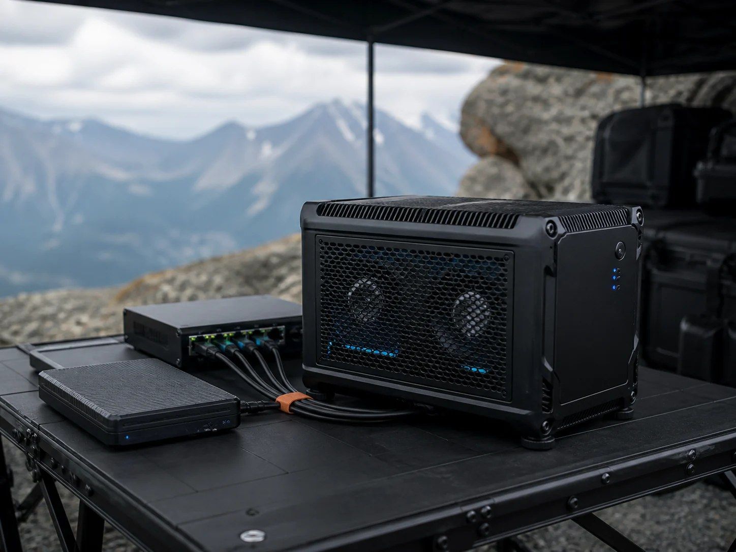 EDGE COMPUTE · VENUE NODEVISION + DIRECTOR
A remote supervisor sees state, journal, alarms and service actions for every node. Manual override exists for commissioning, test flights and emergency takeover — not for daily operation.
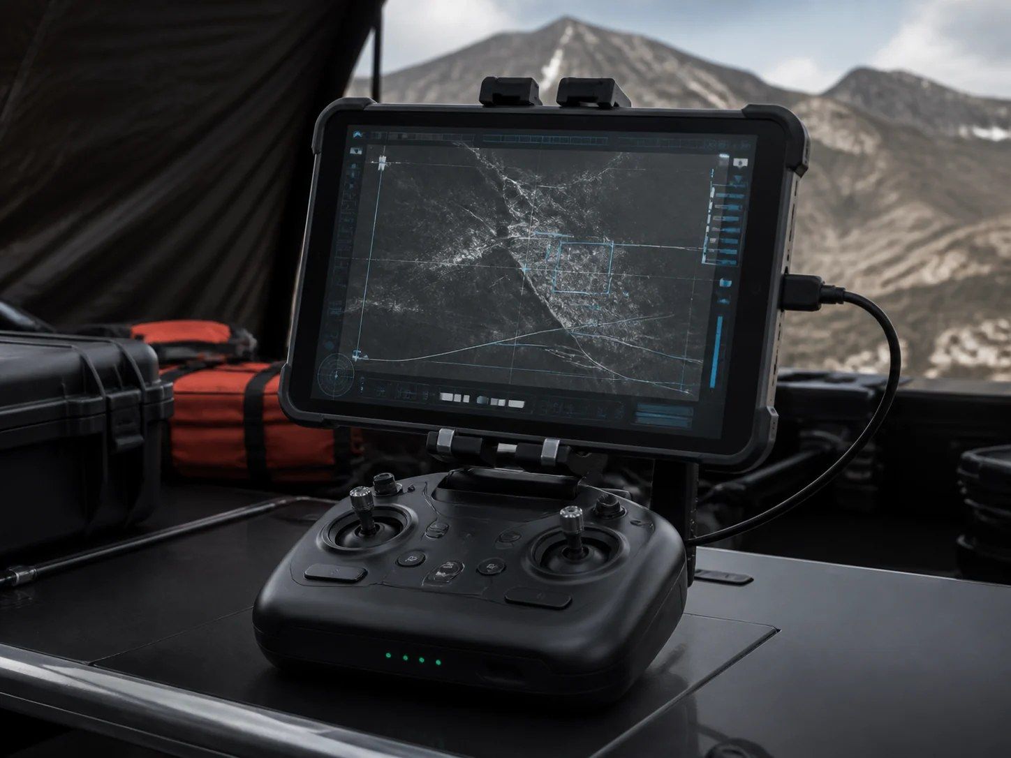 SUPERVISOR · REMOTE OPSOVERRIDE READY
The subject carries an active GNSS/4G beacon; vehicles can add a fiducial roof marker for visual confirmation at close range. Together they give the system a unique, unambiguous target — no biometrics involved.
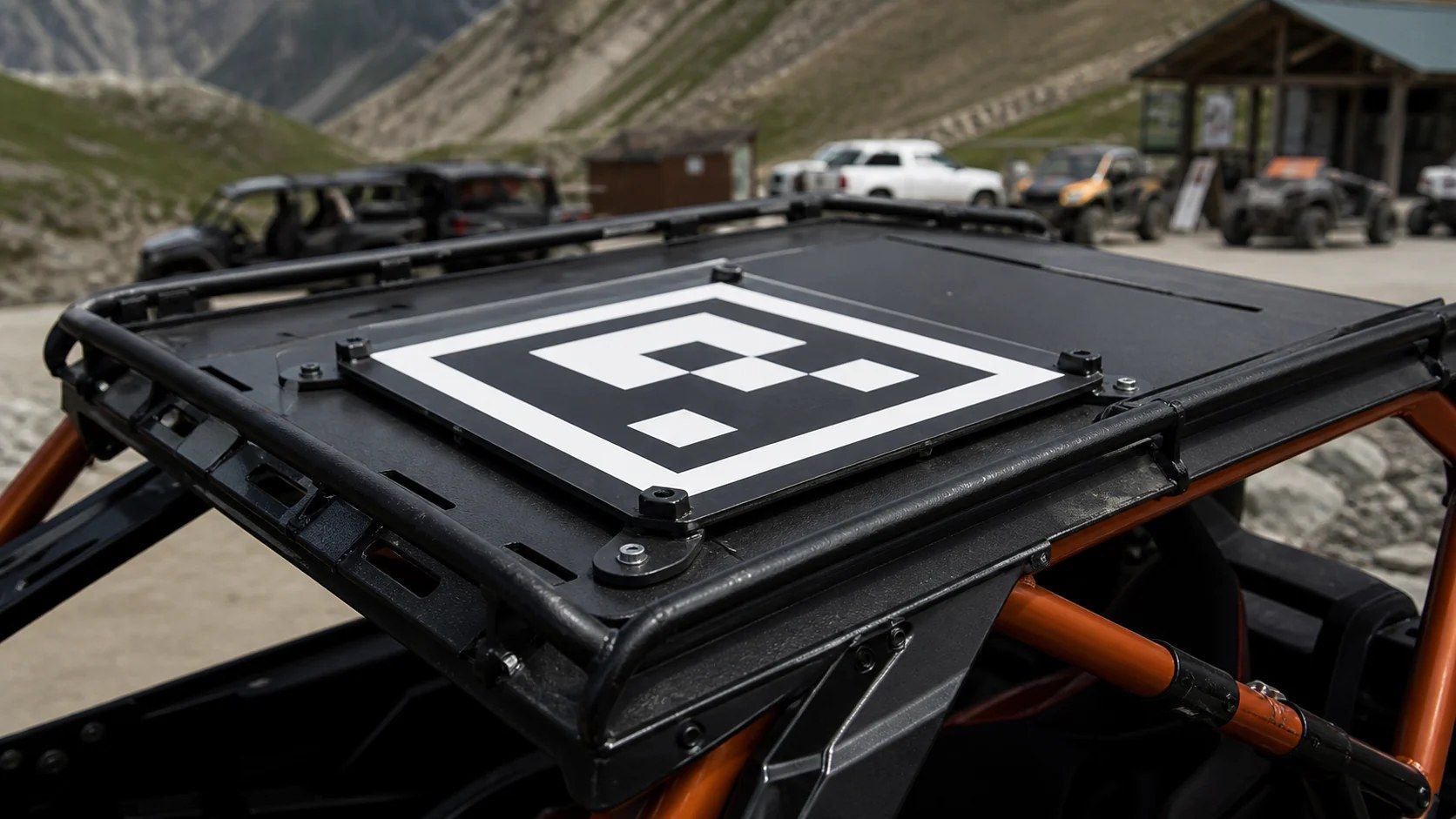 TAG AE-77 · FIDUCIAL CONFIRMID LOCK
Trajectories, framing decisions, purchased edits and ratings feed back into the models. Intelligence learned on buggy trails transfers to sport, agriculture and B2B — that is the compounding asset.
Architecture, safety rules, acceptance criteria and the POC plan are documented. Partners and investors can request the full pack.